Wrangel Island is washed by the East Siberian Sea on the western side and the Chukchi Sea on the eastern side. Herald Island is a mountain remnant located 60 km east of Wrangel Island in the Chukchi Sea.
Wrangel Island is located north of Chukotka, between 70-71°N. and 179°W - 177°E An important feature of the geographical position of the island is the fact that it is the only large land located at high latitudes in the northeastern sector of the Asian Arctic, in the zone of the continental shelf, the boundary of which ends approximately 300 km north of the island. At the same time, Wrangel Island is located close not only to Asia, but also to North America, and to the Bering Strait separating these continents, which serves as the only highway connecting the Pacific and Arctic Oceans and a breeding ground for many species of marine animals.

The island is separated from the mainland by the Long Strait, the average width of which is 150 km, which provides reliable isolation from the mainland. At the same time, the area of Wrangel Island is large enough to ensure biological and landscape diversity. Other Arctic islands and archipelagos are separated from Wrangel Island by hundreds of kilometers.
Until the last rise in the level of the world's oceans, Wrangel Island was part of a single Beringian land.
The greatest length diagonally from northeast to southwest (between Capes Waring and Blossom) is about 145 km, and the maximum width from north to south (traverse Pestsovaya Bay - Krasin Bay) is a little more than 80 km. Approximately 2/3 of the area of the island is occupied by mountain systems with the highest height of 1095.4 m above sea level. (Sovetskaya).
Wrangel Island is one of the highest islands in the Euro-Asian sector of the Arctic and the highest island without ice cover in the Arctic in general. The island is characterized by a strong dissection of the relief and a wide variety of geological and geomorphological structures.
The Wrangel and Herald Islands, according to climatic conditions, landscape features and vegetation cover, belong to the arctic tundra subzone (the northernmost subzone of the tundra zone).

GEOGRAPHY OF WRANGEL ISLAND
Wrangel Island (Chuk. Umkilir - “island of polar bears”) is a Russian island in the Arctic Ocean between the East Siberian and Chukchi Seas. Named after the 19th century Russian navigator and statesman Ferdinand Petrovich Wrangel.
It is located at the junction of the western and eastern hemispheres and is divided by the 180th meridian into two almost equal parts.
Administratively, it belongs to the Iultinsky district of the Chukotka Autonomous Okrug.
It is part of the reserve of the same name. It is a UNESCO World Heritage Site (2004).
Archaeological finds in the area of the Chertov ravine site indicate that the first people (paleo-Eskimos) hunted on the island as early as 1750 BC. e.
The existence of the island was known to Russian pioneers since the middle of the 17th century according to the stories of local residents of Chukotka, but it only got on geographical maps two hundred years later.

Opening
In 1849, the British explorer Henry Kellett discovered in the Chukchi Sea new island and named it Herald Island after his ship Herald. To the west of the island, Herald Kellett observed another island and marked it on the map. The island got its first name: "Kellett's Land".
In 1866, the first European visited the western island - Captain Eduard Dallmann (German: Eduard Dallmann), who conducted trade operations with the inhabitants of Alaska and Chukotka.
In 1867, Thomas Long, an American whaler by profession and explorer by vocation, - perhaps not knowing about Kellett's previous discovery, or misidentifying the island - named it after the Russian traveler and statesman Ferdinand Petrovich Wrangel.
Wrangel knew about the existence of the island from the Chukchi and unsuccessfully searched for it during 1820-1824.
In 1879, the path of the expedition of George De Long lay near Wrangel Island, who tried to reach the North Pole on the ship Jeannette (eng. "USS Jeannette"). De Long's voyage ended in disaster, and in 1881, the American steam cutter Thomas Corwin under the command of Calvin L. Hooper approached the island in search of him. Hooper landed a search party on the island and proclaimed it a US territory.
In September 1911, the Vaigach icebreaker from the Russian hydrographic expedition of the Arctic Ocean approached Wrangel Island. The crew of the Vaigach surveyed the coast of the island, landed and raised the Russian flag over it.
Herald Island, satellite of Wrangel Island 
Canadian Arctic Expedition 1913-1916
On July 13, 1913, the brigantine of the Canadian Arctic expedition "Karluk" (born "Karluk"), led by anthropologist V. Stefanson, left the port of Nome (Alaska) to explore Herschel Island in the Beaufort Sea. August 13, 1913, 300 kilometers from the destination, "Karluk" was caught in the ice and began a slow drift to the west. On September 19, six people, including Stefanson, went hunting, but due to the drift of the ice, they could no longer return to the ship. They had to make their way to Cape Barrow. Later, allegations were made against Stefanson that he deliberately left the ship on the pretext of hunting in order to study the islands of the Canadian Arctic archipelago.
25 people remained on the Karluk - the team, members of the expedition and hunters. The drift of the brigantine continued along the route of George De Long's barque Jeannette until it was crushed by ice on January 10, 1914.
The first party of sailors, on behalf of Bartlett and under the command of Bjarne Mamen, set out for Wrangel Island, but mistakenly reached Herald Island. Sandy Anderson, the senior assistant to the captain of the Karluk, remained on Herald Island with three sailors. All four died, presumably due to food poisoning or carbon monoxide poisoning.
Another party, including Alistair McCoy (a member of Shackleton's Antarctic expedition in 1907-1909), undertook an independent trip to Wrangel Island (at a distance of 130 km) and went missing. The remaining 17 people under the command of Barlett managed to get to Wrangel Island and came ashore in Draghi Bay. In 1988, traces of their camp were found here and a memorial sign was erected. Captain Barlett (who had experience of participating in the expeditions of Robert Peary) and the Eskimo hunter Kataktovik together set off across the ice to the mainland for help. In a few weeks they successfully reached the coast of Alaska, but ice conditions prevented an immediate rescue expedition.
In the summer of 1914, the Russian icebreaking ships Taimyr and Vaigach tried to break through to help twice (August 1-5, then August 10-12), but could not overcome the ice. Several attempts by the American cutter "Bear" (eng. "Bear") were also unsuccessful.
Of the 15 people who remained on Wrangel Island, three died: Malloch from a combination of such causes as overwork, hypothermia, gunren and eating spoiled pemmican; Mamen due to kidney failure, apparently caused by the same pemmican; Braddy, according to some members of the group, was killed by Williamson, who staged an accident while cleaning a revolver. The reason is the difficult psychological atmosphere in the camp of the group. The murder was never proven, Williamson denied all charges. The survivors earned their livelihood by hunting and were only rescued in September 1914 by an expedition on the Canadian schooner King and Wing (eng. King & Winge).
Northern Lights over Wrangel Island 
Expeditions Stefanson 1921-1924
Encouraged by the experience of the survival of the crew of the Karluk and the prospects for marine fishing off Wrangel Island, Stefanson launched a campaign to colonize the island. To support his enterprise, Stefanson tried to get official status from first the Canadian and then the British government, but his idea was rejected. The refusal, however, did not prevent Stefanson from declaring support for the authorities and then raising the flag of Great Britain over Wrangel Island. As a result, this led to a diplomatic scandal.
On September 16, 1921, a settlement of five colonists was founded on the island: 22-year-old Canadian Alan Crawford, Americans Galle, Maurer (a member of the expedition on the Karluk), Knight and an Eskimo woman Ada Blackjack as a seamstress and cook. The expedition was sparsely equipped, as Stefanson relied on hunting as one of his main sources of supply.
Having successfully overwintered the first winter and having lost only one dog (out of seven available), the colonists hoped for the arrival of a ship with supplies and a change in the summer. Due to severe ice conditions, the ship could not approach the island and people stayed for another winter.
In September 1922, the Magnit gunboat of the White Army (a former messenger ship armed during civil war) under the command of Lieutenant D. A. von Dreyer, but the ice did not give her such an opportunity. Opinions differ on the purpose of the Magnit’s trip to Wrangel Island - this is the suppression of the activities of Stefanson’s enterprise (expressed by contemporaries and participants in the events), or, on the contrary, providing him with assistance for a fee (expressed in the newspaper of the FSB of Russia in 2008). Due to the military defeat of the White movement in the Far East, the ship never returned to Vladivostok, the Magnit crew went into exile.
After the hunt failed and food supplies ran out, on January 28, 1923, three polar explorers went to the mainland for help. Nobody else saw them. Remaining on Knight Island, he died of scurvy in April 1923.
Only 25-year-old Ada Blackjack survived. She managed to survive alone on the island until the arrival of the ship on August 19, 1923.
In 1923, 13 settlers remained on the island for the winter - the American geologist Charles Wells and twelve Eskimos, including women and children. Another child was born on the island during the winter. In 1924, disturbed by the news of the establishment of a foreign colony on Russian island, the government of the USSR sent the gunboat Krasny Oktyabr to Wrangel Island (the former Vladivostok port icebreaker Nadezhny, on which guns were installed).
"Red October" left Vladivostok on July 20, 1924 under the command of hydrographer B.V. Davydov. On August 20, 1924, the expedition raised the Soviet flag on the island and evacuated the settlers. On the way back, on September 25, in the Long Strait near Cape Schmidt, the icebreaker was hopelessly trapped in ice, but a storm helped it free itself. Overcoming heavy ice led to excessive fuel consumption. By the time the ship anchored in Providence Bay, there was 25 minutes of fuel left and no fresh water at all. The icebreaker returned to Vladivostok on October 29, 1924.
Soviet-American, and then Chinese-American negotiations on the further return of the colonists to their homeland through Harbin took a long time. Three did not live to return - the leader of the expedition, Charles Wells, died in Vladivostok from pneumonia; two children died during the ensuing journey.

DEVELOPMENT OF WRANGEL ISLAND
In 1926, a polar station was established on Wrangel Island under the leadership of G. A. Ushakov. Together with Ushakov, 59 people landed on the island, mostly Eskimos, who previously lived in the villages of Providence and Chaplino.
In 1928, an expedition was made to the island on the Litka icebreaker, the boiler room on which the Ukrainian writer and journalist Nikolai Trublaini worked, who described Wrangel Island in a number of his books, in particular “To the Arctic - through the tropics”. In 1948, a small group of domestic reindeer was brought to the island and a department of a reindeer-breeding state farm was organized. In 1953, the administrative authorities adopted a resolution on the protection of walrus rookeries on Wrangel Island, and in 1960, by decision of the Magadan Regional Executive Committee, a long-term sanctuary was created, which in 1968 was transformed into a sanctuary of republican significance.
LIE ABOUT THE GULAG
In 1987, former convict Efim Moshinsky published a book in which he claimed that he was in a "corrective labor camp" on Wrangel Island and met Raoul Wallenberg and other foreign prisoners there. In fact, contrary to legend, there were no Gulag camps on Wrangel Island. 
Wrangel Island (reserve)
In 1975, musk oxen from the island of Nunivak were introduced to the island, and the executive committee of the Magadan Region assigned the lands of the islands to the future reserve. In 1976, to study and protect the natural complexes of the Arctic islands, the Wrangel Island nature reserve was founded, which also included the small neighboring island of Herald. In connection with the reserve, a 5 nautical mile wide buffer zone was established around the islands. total area of the reserve amounted to 795.6 thousand hectares. In 1978, the Scientific Department of the Reserve was organized, whose employees began a systematic study of the flora and fauna of the islands.
In 1992, the radar station was closed, and the only settlement remained on the island - the village of Ushakovskoye, which was empty by 2003.
In 1997, at the suggestion of the governor of the Chukotka Autonomous Okrug and the State Committee for Ecology of Russia, the area of the reserve was expanded by including in its composition the water area surrounding the island with a width of 12 nautical miles, by order of the government of the Russian Federation N ° 1623-p dated November 15, 1997, and in 1999, around the already protected water area, by decree of the governor of the Chukotka Autonomous Region N ° 91 of May 25, 1999, a buffer zone 24 nautical miles wide was organized. Wrangel Island 
Modernity
Various military exercises are regularly held on the island.
In 2014, the Eastern Military District will deliver more than 2.5 thousand tons of various cargoes to Cape Schmidt and Wrangel Island in 2014 as part of the northern delivery.
August 20, 2014 sailors Pacific Fleet under the command of Captain 3rd Rank Evgeny Onufriev, who arrived on Wrangel Island to carry out hydrographic work on the ship Marshal Gelovani, raised the Naval Flag over the island, thus establishing the first base of the Russian Pacific Fleet on it.
NATURE OF WRANGEL ISLAND
The area of the island is about 7670 km², of which about 4700 km² are mountains. The shores are low-lying, dissected by lagoons, separated by sandy spits from the sea. The central part of the island is mountainous. There are small glaciers and medium-sized lakes, arctic tundra.
Climate
The relief of Wrangel Island determines significant thermal differences within its limits. Thus, at different points on the southern coast, the average July temperature ranges from 2.4 to 3.60С, which corresponds to the range of the arctic tundra subzone; on the northern coast, the same indicator fluctuates around 10С (as in the polar deserts), and in the intermountain basins of the central part of the island, it reaches 8-100С, which is typical for the southern margin of the tundra zone.
The climate in the region of the islands is arctic with a significant influence of cyclonic activity. For most of the year, cold arctic air masses dominate here, which are characterized by low temperatures and a low content of moisture and dust. In summer, they are forced out by warmer and more humid air masses from the Bering Sea. Dry, dusty or continental air masses from Siberia are not rare here either. The average annual air temperature is -11.3°C. The coldest month is February (-24.9°С), the warmest is July (2.5°С).
The frost-free period on the islands usually does not exceed 20-25 days, often being only about 2 weeks. During the year, an average of 152 mm of precipitation falls here, of which about half falls on the snowy months. The winter period is characterized by strong and prolonged northeast winds, the speed of which often exceeds 40 m/s. At the same time, the snowfall is significantly redistributed depending on the landforms and wind direction, forming a very uneven snow cover - from its absence in blown areas to multi-meter thicknesses in lowlands and on leeward slopes. Much of the snowfall is carried by the wind to the sea.
Meso-climatic differences are well expressed on the territory of Wrangel Island. The central sector of the island is characterized by a more continental climate compared to the coastal (western and eastern sectors), which are characterized by lower summer temperatures, later snowmelt, and a much greater frequency of cloudy weather and fogs.
Relief
Approximately 2/3 of the territory of. Wrangel is occupied by mountains. In the central part of the island to the north and south of the Central Mountains, two longitudinal wide (up to 3 km) valleys are traced in the latitudinal direction. The highest point of the island is Mount Sovetskaya 1096 m. The central mountainous part of Wrangel Island is a middle mountain towering above the entire island.
The mid-mountain massif is strongly dissected by numerous valleys. The tops of the mountains, with the exception of a few of the highest with alpine-type outlines, are predominantly plateau-like. From the west, north and south, the middle mountains are surrounded by a strip of low mountains and hills, which are highly dissected peneplens with elevations from 200 to 600 m. The low mountains are also densely dissected by valleys, among which several especially large ones stand out, forming vast intermountain basins. The mountain structures of the island from the north and south are bordered by accumulative plains, composed mainly of alluvial deposits, with ridges and ridges rising 10-15 m above the general level.
The northern valley is confined to a large latitudinal fault, and the southern one is confined to the boundary of strata of different ages and different facies. The northern and southern parts of the island are occupied by low-lying tundra. The northern lowland Tundra of the Academy is a slightly hilly lowland with absolute elevations from 5-10 to 30-50 m. The plain tundra in the southern part of the island is identical in character to the Tundra of the Academy. The absolute marks of its heights at the foot of the Central Mountains reach 100 m. On the western side of the island there is a seaside narrow plain.
The flat shores of the island are predominantly of the lagoonal type and are characterized by an abundance of sand and pebble spits and bars. Where mountain structures go to the sea, various types of abrasion shores develop, characterized by rocky cliffs up to several tens of meters high. Herald Island is a high remnant, composed of granites and gneisses, ending on all sides in the sea with steep rocky ledges up to 250 m high. Both islands are characterized by various cryogenic forms of nano- and micro-relief, among which various polygonal and spotty forms predominate. In the lowlands of the plains of Wrangel Island, thermokarst basins are also developed, and in the intermountain valleys - baidzharakh complexes formed as a result of the melting of polygonal vein ice.
In accordance with the landscape-ecological zoning of the territory of Russia (Isachenko, 2001), Wrangel Island is part of the Chukotka-Koryak group of provinces in the Far Eastern sector of the subarctic zone. However, most researchers (Aleksandrova, 1977; Khromov, Mamontova, 1974, etc.) attribute it to the Arctic zone. The island as a whole is characterized by the development of arctic-type landscapes, including polar-desert and arctic-tundra subtypes. In accordance with the botanical and geographical zoning of the Arctic (Aleksandrova, 1977), Wrangel Island belongs to the Wrangel subprovince of the Wrangel-West American province of the Arctic tundra. All the main types of Arctic landscapes are represented on Wrangel Island. Plains, abrasion and accumulative in origin, give a wide range of morphological types, including low-lying and elevated, flat, hilly and sloping.
On the territory of the island, Markov (1952) and V.V. Petrovsky (1985) identified 5 regions characterized by relatively homogeneous geological and geomorphological conditions and features of plant communities: the tundra of the Academy, the Southern region, the Western region, the Central region and the Eastern region.
Wrangel Island, coast of the Chukchi Sea 
Hydrology and hydrography
In total, there are more than 140 rivers and streams on the island with a length of more than 1 km and 5 rivers with a length of more than 50 km. All streams are fed by snow. Of the approximately 900 lakes, most of which are located in the Academy Tundra (north of the island), 6 lakes have an area exceeding 1 km². On average, the depth of the lakes is not more than 2 m. By origin, the lakes are divided into thermokarst, which include the majority, oxbow (in the valleys of large rivers), glacial, dammed and lagoonal. The largest of them are: Kmo, Komsomol, Gagachye, Zapovednoye. The entire surface of the island is dissected by an intensively developed river network. All more or less large rivers originate within large mountain ranges, where their valleys are usually narrow, with steep slopes and canyons in some areas. Mountain streams and rivers have a relatively shallow depth with a small channel width. Their valleys are deeply incised, they are distinguished by an equilibrium profile that has not yet been established. The mountain streams that flow across the stretch of the structures have steep rocky shores for almost their entire length. With access to the plains, the channels of watercourses expand sharply: the streams are divided into several branches, meanders, reaches, and rifts appear. The watercourses of the Academy Tundra are characterized by a calm current in meandering channels. Erosion incision in them is weakly expressed. There is an abundance of oxbow lakes, especially in the floodplain.
The water area of the East Siberian and Chukchi Seas adjacent to the Wrangel and Herald Islands stands out as a separate Wrangel chemical-oceanographic region, characterized by special types of surface waters with low salinity, high oxygen saturation, and an increased content of biogenic elements. From the Bering Sea, a stream of warm Pacific waters enters here, forming a clearly defined layer at a depth of 75-150. In the northern part of the water area, at a depth of about 150 m, warm Atlantic waters also penetrate.
The ice regime of the water area adjacent to the islands is characterized by the almost constant presence of ice in the summer. The edge of drifting ice, during the period of their minimum distribution, is located in the immediate vicinity of the islands, or slightly to the north-west (in exceptional cases, far to the north). In the Long Strait, throughout the warm period, an ice massif known as the Wrangel ice remains. In the East Siberian Sea, not far from Wrangel Island, there is a spur of the Ayon oceanic ice mass in summer. In winter, the Zavrangelskaya stationary polynya functions to the north or north-west of the island.
East-Siberian Sea. Due to shallow depths, the temperature is characterized by a uniform distribution from the surface to depth. In winter it is -1-20С, in summer +2+50С, in bays up to +80С. The salinity of the water is different in the western and eastern parts of the sea. In the eastern part of the sea near the surface, it is usually about 30 ppm. River runoff in the eastern part of the sea leads to a decrease in salinity to 10-15 ppm, and in the mouths of large rivers to almost zero. Near ice fields, salinity increases to 30 ppm. With depth, salinity rises to 32 ppm Chukchi Sea. The temperature in winter is -1.70С, in summer it rises to +70С. From the southern part of the island, the tides are small, about 15 cm. In winter, an increased salinity (about 31-33 ‰) of the under-ice water layer is characteristic. In summer, salinity is less, it increases from west to east from 28 to 32 ‰. The salinity is lower near the melting ice edges; it is minimal at the mouths of the rivers (3–5 ‰). Salinity usually increases with depth.
The Chukchi Current, which runs from west to east from the East Siberian Sea, and the Gerald and Longovskaya branches of the Bering Sea Current, which run north, northwest, and west into the Long Strait, are described.
Geology
The island is composed of various deposits (metamorphic, sedimentary, igneous, etc.) of a wide age range - from the late Precambrian to the Triassic, which are overlain by Neogene-Quaternary sediments filling depressions in the north and south. Excellent exposure, easy traversability of the tundra and in most cases moderate elevations, good decipherability of objects make the island convenient for geological study. In addition, contacts between strata of different ages are in most cases well expressed in the relief.
Wrangel Island is composed of two main complexes: metamorphic formations and deposits of the Paleozoic-Mesozoic cover.
METAMORPHIC FORMATIONS are exposed in the axial part of the Central and Mammoth mountains. Sedimentary and volcanic rocks, strongly deformed and metamorphosed in greenschist and epidote-amphibolite facies, intruded by dikes and small intrusions of basic and felsic composition, are distinguished as the Wrangel complex [Ivanov, 1969], the lower part of the Berry Formation [Tilman et al., 1970; Ganelin et al., 1989; Bogdanov, 1998], the Gromov and Inkala formations (Kameneva, 1975). The total thickness is estimated at 2000 m. G.I. Based on the finds of microfossils, Kameneva attributed the Gromov Formation to the Middle and Upper Riphean, and the Inkala Formation to the Vendian. ON THE. Bogdanov, S.M. Tilman and V.G. Ganelin and co-authors tend to consider these formations as the result of dynamo-metamorphism of Devonian or Early Paleozoic rocks, which is confirmed by K-Ag dates of 457 ± 25 Ma. During the work of the Soviet-Canadian expedition, zircons were identified, indicating a Late Proterozoic age: 699 ± 1 Ma (zircons from mafic), as well as 609 ± 10, 633 ± 21 and 677 ± 163 Ma (zircons from granites). Our field observations (2006) most likely indicate that the metamorphic complex contains both ancient and Paleozoic formations.
The Paleozoic-Mesozoic cover is composed of Silurian-Devonian, Devonian, Carboniferous, Permian, and Triassic deposits. The contact of the Wrangel complex with the non-metamorphosed cover is most likely tectonic. In the upper reaches of the river Predators, it is clearly expressed in the relief by a ledge and a conjugated saddle covered with vegetation with numerous outcroppings of black shales.
Silurian Devonian. Terrigenous and carbonate deposits of this age are known only in the northern part of the island. The total thickness is 400-500 m.
Devonian. It is represented by sandstones, often quartzites and shales with horizons of conglomerates, gravelstones and limestones. M.K. Kosko et al. describe an unconformable stratigraphic contact of the Devonian with conglomerates at the base on the rocks of the Wrangel Complex. Thickness 600-2000 m.
Lower Carboniferous. In the upper reaches of the river Predators, the lower part of the section is composed of dark gray and black shales with interlayers of dark organogenic limestones. Above is a member of alternating greenish-gray and brown calcareous sandstones, siltstones, and shales. Gradation layering is clearly visible. Marl-calcareous members, interlayers and lenses of carbonate rocks and dolomites with gypsum occur along the strike. This part of the section is characterized by variegated brown, yellow, grey, green and pinkish colors.
Carbon. Pelitomorphic and organogenic limestones with horizons of terrigenous rocks, the number of which increases in the north direction. The total thickness of the deposits is 500-1500 m. In the middle reaches of the river. Unknown are outcrops of volcanic rocks of acidic and basic composition with relics of spherical separation and lenses of jasperoids.
Permian. Shales with interlayers of bituminous limestones and sandstones. The southern part is dominated by shales, while the northern, shallower part contains lenticular horizons of conglomerates. The thickness of the deposits is 800 m in the southern part and 1200 m in the northern part (Kosko et al., 2003).
Triassic. Terrigenous deposits, distributed mainly in the southern part, where they can be traced in a wide strip from Cape Bird's Bazaar to the east coast. The Triassic is characterized by turbidites and an internal folded-scaly structure.
Triassic turbidites overlap various horizons of Paleozoic deposits. Some researchers tend to consider these relationships as unconformable stratigraphic contact, others as a thrust. In the places studied by the authors (R. Khishchnikov, brook Doubtful, Cape Zanes), the contact is tectonic. At the same time, a long history of contact formation cannot be ruled out.
Initially, stratigraphic relationships could exist, then a thrust with a general northern vergence typical of the Wrangel was formed, and at the latest stages faults could occur, including along the thrust plane, due to general extension and the formation of young sedimentary basins on the shelf south of the island.
ground cover
The entire territory of the reserve is located in the zone of permafrost rocks. The soil cover of the islands is relatively well formed. Arcto-tundra soddy and tundra or arctic gley soils predominate. In the most continental central regions of the island, soils that are completely uncharacteristic of the Arctic islands are common - steppe cryoarid and tundra-steppe, characteristic of the sharply continental regions of Siberia and the north. Far East. Under the name of arctic-tundra saline soils, typical solonchaks are also described on the island, moreover, of lithogenic origin, i.e. owing their existence to the effusion water regime, which is typical for arid territories and is completely atypical for the Arctic. In the central regions of the island, the type of arctic-tundra carbonate soils, which is endemic to Wrangel Island, is quite widespread.
On Herald Island near the colonies of seabirds at an altitude of 100-200 m, peat-humus zoogenic soils are well formed, on which the vegetation cover is unusually luxuriantly developed.
Flora
The first researcher of the vegetation of Wrangel Island, B. N. Gorodkov, who in 1938 studied the eastern coast of the island, attributed it to the zone of arctic and polar deserts. After a complete study of the entire island from the 2nd half of the 20th century. it belongs to the arctic tundra subzone of the tundra zone. Despite the relatively small size of Wrangel Island, due to the sharp regional features of its vegetation, it stands out as a special Wrangel subprovince of the Wrangel-West American province of the Arctic tundra.
The vegetation of Wrangel Island is distinguished by a rich ancient species composition. The number of species of vascular plants exceeds 310 (for example, there are only 135 such species on the much larger New Siberian Islands, about 65 on the islands of Severnaya Zemlya, and less than 50 on Franz Josef Land). The flora of the island is rich in relics and relatively poor in plants common in other polar regions, which, according to various estimates, are no more than 35-40%.
About 3% of the plants are subendemic (beskilnitsa, Gorodkov's poppy, Wrangel's poppy) and endemic (Wrangel's bluegrass, Ushakov's poppy, Wrangel's Potentilla, Lapland's poppy). In addition to them, another 114 species of rare and very rare plants grow on Wrangel Island.
The similar composition of the flora allows us to conclude that the original Arctic vegetation in this area of ancient Beringia was not destroyed by glaciers, and the sea prevented the penetration of later migrants from the south.
The modern vegetation cover on the territory of the reserve is open and undersized almost everywhere. Sedge-moss tundra prevails. In the mountain valleys and intermountain basins of the central part of Wrangel Island, there are areas of thickets of willow (Richardson willow) up to 1 m high.
bird market, Wrangel Island 
Quite often, birds from North America fly or are blown into the reserve by the wind, among which are sandhill cranes that regularly visit Wrangel Island, as well as Canada geese and various American small passerines, including finches (myrtle songbirds, savannah buntings, gray and Oregon juncos, black-browed and white-breasted zonotrichia).
The mammalian fauna of the reserve is poor. The endemic Vinogradov's lemming, previously considered a subspecies of the hoofed lemming, the Siberian lemming and the arctic fox live here permanently. Periodically, and in significant numbers, a polar bear appears, whose maternity dens are located within the boundaries of the reserve. From time to time, wolves, wolverines, ermines and foxes penetrate the reserve. Together with people, sled dogs settled on Wrangel Island. The house mouse appeared and lives in residential buildings. Reindeer and musk ox were brought to the island for acclimatization.
Reindeer lived here in the distant past, and the modern herd comes from domestic deer brought in 1948, 1954, 1967, 1968, 1975 from the Chukotka Peninsula. The deer population is maintained in the amount of up to 1.5 thousand heads.
There is evidence that musk oxen lived on Wrangel Island in the distant past. In our time, a herd of 20 heads was imported in April 1975 from the American island of Nunivak.
On the territory of the island is the largest walrus rookery in Russia. Seals live in coastal waters.
In the mid-1990s, you could read about a startling discovery made on the island in Nature magazine. An employee of the reserve Sergey Vartanyan discovered here the remains of woolly mammoths, whose age was determined from 7 to 3.5 thousand years. Despite the fact that, according to popular belief, mammoths died out everywhere 10-12 thousand years ago. Subsequently, it was discovered that these remains belong to a special relatively small subspecies that inhabited Wrangel Island back in the days when the Egyptian pyramids, and which disappeared only in the reign of Tutankhamun and the heyday of the Mycenaean civilization. This puts Wrangel Island among the most important paleontological monuments of the planet.
remains of the village Doubtful 
Settlements
Ushakovskoye (non-residential)
Zvezdny (non-residential)
Perkatkun (non-residential)
Population
Officially, the village of Ushakovskoye on Wrangel Island was declared uninhabitable in 1997. However, several people refused to leave.
The last 25-year-old female islander named Vasilina Alpaun was killed by a polar bear in 2003.
After her, only the man Grigory Kaurgin, who practices shamanism, remained on the island from the civilians. The presence of people on the island was again ensured by the Russian military from the troops of the Eastern Military District (VVO), who on October 1, 2014 settled in the military camp created for them.
RESERVE WRANGEL ISLAND
"Wrangel Island" is a state nature reserve, occupies the northernmost position (located mainly to the north of 71 ° N) from the protected areas of Russia.
The State Nature Reserve "Wrangel Island" was established by the Decree of the Council of Ministers of the RSFSR of March 23, 1976 No. 189. The total area is 2,225,650 hectares, including the water area - 1,430,000 hectares. The area of the protected zone is 795,593 hectares. It occupies two islands of the Chukchi Sea - Wrangel and Herald, as well as the adjacent water area, and is located on the territory of the Shmidtovsky district of the Chukotka Autonomous Okrug.
This northernmost of the reserves of the Far East occupies two islands of the Chukchi Sea - Wrangel and Gerald, as well as the adjacent water area, and is located on the territory of the Eastern Region of the Chukotka Autonomous Okrug.
Landscape
Approximately 2/3 of the territory of. Wrangel is occupied by mountains. Arctic tundra and mountains are the predominant landscape. The hydrographic network of Wrangel Island consists of about 150 relatively small rivers and streams, only 5 of which have a length of more than 50 km, and about 900 medium-sized shallow lakes.
The flora of Wrangel Island has no analogues in the Arctic in terms of its richness and level of endemism. To date, 417 species and subspecies of vascular plants have been identified in the reserve. This is more than is known for the entire Canadian Arctic Archipelago and is 2-2.5 times higher than the number of species in other Arctic tundra areas of similar size. About 3% of the flora of Wrangel Island are subendemic species. Among the vascular plants, 23 taxa are endemic to the island. In terms of the number of endemics, Wrangel Island has no equal among the Arctic islands, including Greenland. A number of endemic plants (Oxytropis ushakovii, Papaver multiradiatum, and Papaver chionophilum) are common on the island. Endemic species also include a variety of beskilnitsa, a subspecies of the Lapland poppy, poppies Gorodkov and Ushakov, Potentilla Wrangel. The number of known species of mosses (331) and lichens (310) on Wrangel Island also exceeds other areas in the Arctic tundra subzone.
Sedge-moss tundras predominate, the middle and lower belts of the mountains are occupied by grass-lichen and shrub-forb tundras. There are swamps with the participation of sphagnum, low and creeping willow thickets along the ground. In the upper belts of the mountains there are extensive stony placers.
Natural conditions do not favor the richness of the fauna.
There are absolutely no amphibians and reptiles in the reserve; fish (cod, capelin and some others) can only be seen in coastal waters. On the other hand, there are 169 species of birds on the island, most of which are vagrant, nesting is registered for 62 species, of which 44 species nest regularly on the islands, including 8 species of seabirds. For example: gulls, guillemots, etc. Among the birds, we must first of all mention the white goose, which forms its only large autonomous nesting colony of several tens of thousands of pairs that has survived in Russia and Asia. Black geese regularly nest (moreover, thousands of non-breeding geese come here to molt from mainland Chukotka and Alaska), common eider and comb eider, Siberian eider, pintails and sandpipers in very small numbers. On the steep sea shores there are bird colonies, numbering in the 60s, according to the well-known explorer of the North S. M. Uspensky, 50-100 thousand thick-billed guillemots, 30-40 thousand kittiwakes, 3 thousand cormorants. V. V. Dezhkin in the book “In the world of protected nature”, published in 1989, writes “Now there are fewer of these birds”, and on the official website of the reserve, the total number of seabird colonies is estimated at 250-300 thousand nesting individuals.
The basis of the bird population is tundra species, most of which have circumpolar ranges and are common to all arctic tundras. These are Lapland plantain, snow bunting, tules, turnstone, Icelandic sandpiper and a number of other species. At the same time, there are cases of nesting of species uncharacteristic for the Arctic, such as turukhtan, red-throated sandpiper, ipatka and puffin, talovka warbler, for which Wrangel Island is the northernmost nesting point. Ipatka in recent years began to nest on the colonies of seabirds of Wrangel Island regularly and its numbers are growing.
The world of mammals is poorer, and its most typical representatives are the Siberian lemming and Vinogradov's lemming, which in the years of high abundance are of great importance in the ecosystems of the reserve. Arctic fox, ermine, wolverine, feral reindeer, wolves live, red foxes wander. But the most eminent inhabitant of both islands is the polar bear. The Wrangel and Herald Islands are known as the world's largest concentration of polar bear birth dens. V.V. Dezhkin writes: “In some years, up to 200-250 she-bear dens were arranged in the reserve.” On the website of the reserve there is information that “from 300 to 500 she-bears annually lie in dens on the islands. Approximately 100 ancestral lairs of this number are arranged on a small about. Gerald". In the spring, with slightly stronger offspring, they embark on a journey through the expanses of the Arctic.
Ungulates are represented in the reserve by two species - reindeer and musk ox. Reindeer were brought to Wrangel Island in the late 1940s and early 1950s: domestic reindeer were brought in two batches from the coast of Chukotka. At present, they represent a unique in history and biological characteristics of the island population of feral reindeer, the number of which in certain periods reached 9-10 thousand individuals. In 1975, a year before the establishment of the reserve, 20 musk oxen caught on the American island of Nunivak were brought to Wrangel Island. The period of adaptation of musk oxen on the island and their development of the entire territory passed with difficulties and was extended for several years, after which the survival of the original herd was no longer in doubt and the population began to grow rapidly. At present, the number of musk oxen on the island is about 800-900 individuals, according to the situation in the autumn of 2007 - perhaps up to 1000. According to paleontological data, both species of ungulates lived on the territory of Wrangel Island in the late Pleistocene, and reindeer and much later - only 2 -3 thousand years ago.
Finally, walruses, the most interesting and valuable marine animals, haul out on the coasts of the reserve. Their protection and study are the task of local scientists. The Pacific walrus lives here, for which this water area is the most important summer feeding area. In certain years, in the summer-autumn period - from July to the end of September-beginning of October - most of the females and young of the entire population accumulate near the islands. Walruses stay at the ice edge and prefer to crawl out to rest on ice floes, as long as they are in the water area. When the ice disappears near the most feeding shallow areas, walruses approach the islands and form the largest coastal rookeries in the Chukchi Sea on certain spits. At the same time, up to 70-80 thousand animals were recorded at the coastal haulouts of walruses on Wrangel Island, and up to 130 thousand walruses gathered here taking into account the animals swimming in the water. For wintering, walruses migrate to the Bering Sea.
Throughout the year, ringed seals and bearded seals are common in coastal waters. The ringed seal is the main food for polar bears throughout the year, providing a complete predator life cycle.
In the summer-autumn period, the water area adjacent to the Wrangel and Herald Islands is an area for feeding and migration of cetaceans. The gray whale is the most numerous here. In recent years, the number of gray whales in the summer-autumn period off the coast of Wrangel Island has increased markedly. Every year, large herds of beluga whales pass along the coast of Wrangel Island on their autumn migration. According to satellite tagging data, it was found that beluga whales approach Wrangel Island in autumn, which gather to give birth in the Mackenzie River Delta (Canada).
The purpose of creating the reserve is to preserve and study the typical and unique ecosystems of the island part of the Arctic, as well as such animal species as the polar bear, walrus, the only breeding population of the white goose in Russia, and many other species of the Beringian flora and fauna with a high level of endemism. In 1974, a musk ox was acclimatized on the island.
Particularly valuable natural objects
Thomas Creek Valley with adjacent slopes
high concentration of polar bear birth dens, high density of family groups and female polar bears in autumn
Cape Blossom area
walrus rookery on the spit; high concentration and activity of polar bears in autumn; concentrations of pink and white gulls on autumn migration; walrus concentration area and gray whale feeding area in coastal waters
Spit Doubtful
walrus rookery; a place of high activity and concentration of polar bears in autumn
Southern coast near the Doubtful Bay
cryophyte-steppe and tundra-steppe plant communities; rare and endemic plant taxa; yellow-throated nesting sites; area of concentration on migration of pink and white gulls; area of high activity of polar bears in autumn
Mouth section of the Mammoth River and Jack London Lake
high concentration of molting black geese; concentrations of waders on autumn migration; a large colony of fork-tailed gulls; area of high activity of polar bears in autumn
Middle course of the Mamontovaya river
cryophyte-steppe and tundra-steppe plant communities; relict communities of arctic continental halophytes; high density of snowy owl nests and reproductive burrows of arctic fox; numerous small colonies of white goose and other lamellar-beaked birds around nests of snowy owls; nesting sites for yellow-throated sandpiper and Baird's sandpiper; high density and diversity of lemming colony types
Gusinaya river valley
relic tundra-steppe communities, growths of willows; high density of snowy owl nesting; numerous white goose colonies around snowy owl nests; nesting sites of Baird's Sandpiper; high concentration and diversity of lemming colony types
Kit mountain range
nesting area of Baird's sandpiper, yellow-breasted goose, concentration of molting black geese; a large colony of fork-tailed gulls; high diversity of lemming colonies
West coast (section from Cape Thomas to the mouth of the Sovetskaya River)
high concentration of polar bear ancestral dens on the coastal slopes of mountains, high activity of polar bears in autumn; large colonies of seabirds (kitti, thick-billed guillemots, Bering cormorants, ipatki); nesting sites of Baird's Sandpiper; unique and highly aesthetic geological structures (I-VI); arctic continental halophytes
Cape Warring area
high concentration of polar bear birth dens; high activity of polar bears in autumn; large colonies of seabirds (kitti, thick-billed guillemots, Bering cormorants, ipatki); the highest density of Baird's sandpiper, membranous tie; location of rock crystal and calcite; unique geological structures
The headwaters of the Neizvestnaya River (the key section "Upper Neizvestnaya")
most stable and densely populated snowy owl breeding colony known in species range; mixed reproductive populations of snowy owl and arctic fox; very high concentration of lamellar-billed colonies around snowy owl nests; high concentration of micropopulations and communities of relict, endemic and rare plant taxa; overgrowth of willows
The main breeding colony of the white goose in the upper reaches of the Tundrovaya River
the only large white geese colony preserved in Eurasia; with an accompanying unique ecosystem formed in this habitat under the influence of zoogenic factors
Herald Island
the highest concentration of polar bear birth dens known in the species range; walrus rookery; the largest seabird colonies in this sector of the Arctic with a community of related species; unique and highly aesthetic geological structures
Dream Head Ranges, Western Plateau, Warring, part of the Eastern Plateau near Cape Pillar
the main areas of concentration of polar bear ancestral dens on Wrangel Island, areas of high concentration and activity of polar bears in the autumn
Lower Tundrovaya River
high concentration of white geese with chicks during molting; the most stable and densely populated breeding colony of arctic foxes known in the species range; an area of high density nesting fork-tailed gulls; high concentration and diversity of lemming colony types
Lake basins in the Tundra of the Academy from the Medvezhnaya River to the Hydrographov River and the lower reaches of the Neizvestnaya, Pestsovaya, Red Flag and Hydrographov rivers
areas of concentration of white geese with chicks during the period of post-nesting molting; main nesting sites of the fork-tailed gull
___________________________________________________________________________________________
SOURCE OF INFORMATION AND PHOTO:
Team Nomads
Leontiev V.V., Novikova K.A. Toponymic Dictionary of the North-East of the USSR. - Magadan: Magadan book publishing house, 1989, p. 384.
Wikipedia site.
Magidovich I. P., Magidovich V. I. Essays on history geographical discoveries. - Enlightenment, 1985. - T. 4.
Shentalinsky V. Coast of non-random meetings. Magazine "Around the World" (September 1988). Retrieved March 2, 2010. Archived from the original on February 5, 2012.
Krasinsky G.D. On a Soviet ship in the Arctic Ocean. Hydrographic expedition to Wrangel Island. - Edition of Litizdat N.K.I.D., 1925.
Klimenko I. N. Expedition to Wrangel Island, or two lives of the icebreaker "Nadezhny". Primorsky State United Museum named after V. K. Arseniev.
Vize V. Yu. Seas of the Soviet Arctic: Essays on the history of research. - Ed. Glavsevmorput, 1948. - 416 p.
Shentalinsky V. A. Home to man and wild beast. - Thought, 1988. - 236 p.
Shentalinsky V.A. Ice captain. - Magadan book publishing house, 1980. - 160 p.
Vitaly Shentalinsky. Reserve autumn on Wrangel // Around the world. - 1978. - No. 9 (2635).
Vitaly Shentalinsky. The coast of non-random meetings // Around the world. - 1988. - No. 9 (2576).
Gromov L.V. A fragment of ancient Beringia. - Geografgiz, 1960. - 95 p.
Mineev A.I. Five years on Wrangel Island. - Young Guard, 1936. - 443 p.
Mineev A.I. Wrangel Island. - Publishing house of the Glavsevmorput, 1946. - 430 p.
Gorodkov B.N. Polar deserts about. Wrangel // Botanical journal. - 1943. - T. 28. - No. 4. - S. 127-143.
Gorodkov BN Soil and vegetation cover of Wrangel Island // Vegetation of the Far North of the USSR and its development. - L .: Nauka, 1958. - V. 3. - S. 5-58.
Gorodkov B. N. Analysis of the Arctic desert zone on the example of Wrangel Island // Vegetation of the Far North of the USSR and its development. - L .: Nauka, 1958. - V. 3. - S. 59-94.
http://www.photosight.ru/
photo: S. Anisimov, V. Timoshenko, A. Kutsky.
So called Wrangel Island L.V. Gromov, one of the first geologists who explored its bowels in the 1930s. During the Pleistocene epoch, which began about one million years ago, a vast landmass appeared and disappeared again several times, connecting Asia and America and called "Beringia". The last time it existed 25 thousand years ago, during the Sartan glaciation, and disappeared again 10-12 thousand years ago, forming a modern geographical picture of the world. Beringia was the center of the formation of specific tundra-steppe landscapes and the accompanying "mammoth" fauna, typical representatives of which were the mammoth itself, as well as the woolly rhinoceros, saiga, musk ox, reindeer, cave lion and cave bear. It was here that the main path of the settlement of the primitive man of the American continent lay.
 Before the beginning of the polar night.
 Spit Doubtful, November 1997
Wrangel Island thanks to its geographic location and relief features most fully preserved some features of the ancient Beringian landscape. In the center of the island there are many relic sites of tundra-steppe vegetation. A number of plants and insects, as well as some species of birds that live on the island, are more characteristic of the tundra of North America than of our Asian north. Among them are real relics of the Pleistocene, which today are not found anywhere except Wrangel Island. Of the plants, these are the Wrangel bison, the one-flowered arthropod, Wrangel's cinquefoil, and of the insects, the weevil beetle rinchenus. On the island, the remains of many Pleistocene animals that lived here were found: rhinos, musk oxen, wild horses, reindeer, primitive bison, and, of course, mammoths, whose tusks and teeth lie in abundance in river channels and stick out of coastal cliffs. The most recent sensational discovery is also connected with mammoths - on Wrangel Island they outlived their mainland counterparts by 7-8 millennia and died out only 3.5 thousand years ago, during the heyday of Egyptian and ancient Greek civilizations, a little short of our era! In truth, Wrangel Island is one of the last "lost worlds" on Earth.
 The highest peak of Wrangel Island is Mount Sovetskaya. April 1999
 "Snowstorm Island"
This definition belongs to G.A. Ushakov, head of the first Soviet settlement on Wrangel Island. Indeed, the island is considered to be one of the windiest places on the globe. The speed of a hurricane "boron" in the area of Rogers Bay can reach 40 or more meters per second. Completely windless days on the island are the greatest rarity. Even if there is calm in one place, a strong wind can blow in any of the many mountain canyons. Sometimes the boundary between the calm and the windy zone is so pronounced that it is possible to go from blizzard to calm and back to blizzard with a few steps.
 The Drem Head mountain range is one of the main "maternity hospitals" for polar bears. April 1999
 Due to its size (145 kilometers long and 83 kilometers wide) and diverse relief (from the vast coastal plains to the Central Mountains with peaks more than a kilometer above sea level), Wrangel Island has a peculiar climate that distinguishes it from most Arctic islands. The influence of the sea affects the coast, and in winter it is not too cold here (-25 - 30 ° C), but the average temperature of the hottest month - July, varies from only 1.5 to 3.5 ° C. At the same time, the central part of the island , surrounded by mountains, has a pronounced continental climate: in summer, intermountain basins warm up to 8-10 ° C, and even over 20 ° C, while in winter there are regular frosts down to -40 -50 ° C. Simply put, Wrangel Island - a real little "mainland"!
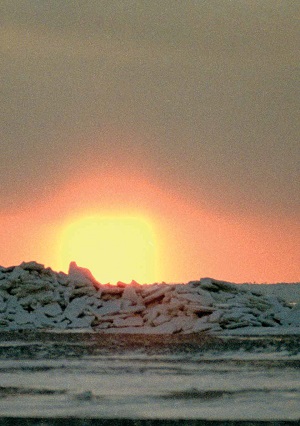
 Sunset over Mount Atterton. September 1994
 "Island of Discord"
 The village of Ushakovskoye in September 1989
 This name was given to Wrangel Island by William McKinley, using a bitter play on words: Wrangel (Wrangel) and Wrangle (quarrel, discord). McKinley was the meteorologist for the Canadian Arctic Expedition aboard the Karluk. The ship received a hole and sank in January 1914. Part of the team crossed the ice to Herald Island, where they died. The rest of the people (17 people) went to the northern coast of Wrangel Island, losing four more along the way. Captain Bartlett, accompanied by one of the Eskimos, crossed the ice of the Long Strait on foot, reached Providence Bay through the whole of Chukotka, from there on a random ship moved to Alaska and returned in September of the same year at the head of a rescue expedition. Bartlett accomplished an unparalleled feat that will forever remain in the Arctic tablets.
The first "Robinsonade" on the island was accompanied by fear and despair. People did not trust each other, hid food from prying eyes, and often quarreled. Two people died of inflammation of the kidneys, one shot himself, another went mad. The survivors remembered Wrangel Island only as a nightmarish, hellish place...
The history of the island was strange and bizarre. Those who wanted to find him, who overcame many obstacles on the way to him, could not even see him. And the discovery and the first studies of it were made along the way, between times, and both of them happened during the search for the lost expeditions ... The island changed one name after another: Doubtful Island, Tikegen Land, Kellet Land, New Columbia, and, finally, Wrangel Island ... Changed state flags: English, American, Canadian, Russian, Soviet, and, finally, Russian ... Became an arena for political and human passions, tragic events that were destined to play a role in the history of Russia, yes and the whole world.
In the XVII-XVIII centuries, Russian explorers and Cossacks often reported on unknown lands located not far from the Chukchi coast. Most often, the American continent was meant, but among the descriptions and sketches of that time one can also catch hints of Wrangel Island. The first cartographic image of the island is considered to be a drawing by the Yakut clerk Ivan Lvov, made in 1710-1714. Probably, taking this drawing as a basis, Mikhail Lomonosov himself very accurately indicated the location of a certain “Doubtful Island” in 1763 on his map. At that time, there were many reports of lands lying north of Chukotka, so the search for Wrangel Island was intricately intertwined with the discovery of the Bear Islands at the mouth of the Kolyma, as well as with the search for the mythical lands of Sannikov and Sergeant Andreev. Finally, in 1821-1823. several sleigh trips on the ice in the East Siberian Sea were made by Fleet Lieutenant F.P. Wrangel, who collected the most accurate information about the location of the island from the words of the Chukchi who lived in the vicinity of Cape Shelagsky. During the third campaign from the Aachim Peninsula, Wrangel reached the latitude of the island and was some 100 km from its western coast, when a huge polynya blocked his path. From high hummocks he tried to see the ground, but in vain. Wrangel did not see the land, later named after him. If he had taken a direction to the northeast, he would have come to the area of Cape Blossom and discovered his island, but fate decided otherwise ...
 Islanders.
 There is an Eskimo Yuri Alpaun,
sitting Chukchi Grigory Kaurgin.
Krasin Bay, August 1990
After 26 years, the sailor of the English ship "Herald" under the command of Captain Kellet, cruising in the Chukchi Sea in search of the missing expedition of John Franklin, was the first European to see the mountains of Wrangel Island. On the same day, Herald Island was discovered 60 km to the northeast. For the first time, the American whaling barque "Nile" of Captain T. Long approached the coastline of Wrangel Island in 1867, after whom the strait between the island and the mainland was named. In 1879, the Jeannette, jammed with ice, drifted past Wrangel Island, the crew of which later died on the Yakut coast. The search for this disappeared expedition in 1881 led to Wrangel Island at once two American ships "Thomas Corvin" and "Rogers", commanded by Captains Hooper and Berry. It is these navigators who have the priority of the first explorers of the island, and the English names of capes, rivers and mountains are still largely preserved on the map, having survived the Soviet era.
The development of the island was accompanied by no less tragic events, and it happened as a result of another strife. Friction arose between the USSR and Canada, which in those years was a British dominion. Here is how it was. Until 1924, Russian ships made only three attempts to reach Wrangel Island. In 1876, the clipper ship Horseman failed due to heavy ice blocking her path. In 1911, members of the famous hydrographic expedition of the Arctic Ocean landed on the southwestern coast of the island from the Vaigach icebreaker. Again, the Vaigach tried to break through the ice to the island in 1914 to save the crew of the Karluk, but broke the screw and retreated.
However, the "Robinsonade" of 1914 attracted the attention of the famous Canadian polar explorer Vilyalmur Stefanson, the head of the expedition, which included the Karluk, to Wrangel Island. He believed that Canada, and with it the British Empire, could claim the Wrangel and Herald Islands, despite the Russian note of 1916, which secured the ownership of these islands by Russia. In 1921, Stefanson sent a five-man detachment under the leadership of Alan Crawford to the island to explore and establish a fishing base that would allow Canada to declare hitherto desert island with their property. And again - a tragedy! In the autumn of 1923, when the ship "Donaldson" came to take out Crawford's party, it turned out that there was practically no one to take. All Europeans, including the chief, died, only the Eskimo Ada Blackjack survived. Nevertheless, another shift was landed on the island - 13 Eskimos, led by the former hairdresser Wells. The attempts of Canadians to colonize Wrangel Island became known in Moscow. In 1924, the Red October gunboat was sent to the island under the command of B.V. Davydov. The Canadian colonists were removed from the island, Wells died of pneumonia upon arrival in Vladivostok, and the Eskimos were sent to Alaska.
But the end was not put on this. In the same 1924, having enlisted the support of the United States government, businessman Karl Loman, the founder of domestic reindeer breeding in Alaska, equipped 3 ships at once on Wrangel Island. This campaign ended in failure, only the ship "Herman" reached the island of Herald. A Soviet-American confrontation over Wrangel Island was avoided.
Finally, in 1926, a Soviet settlement of 51 Eskimos and 9 Russians was founded on the island in Rogers Bay, headed by the first "chief of the island" G.A. Ushakov (who was later the first explorer of Severnaya Zemlya, the head of the high-latitude expedition on the steamer Sadko and the head of the Main Directorate for Hydrometeorology under the Council of People's Commissars of the USSR, and then worked for many years at the Academy of Sciences). The village that grew up on this site was named Ushakovsky, in honor of its founder. Now no one raised the question of the nationality of the Wrangel and Herald Islands. However, as recently as 1986, the US Senate considered the application of the state of Alaska for the rights to these islands ...
Many more tragic events have seen Wrangel Island in its lifetime: the crash of the Chelyuskin, which was trying to bring a team of winterers to the island; famine and epidemic among the Eskimos in the winter of 1934-1935, when 12 people died; textbook "murder case" of doctor N.L. Wolfson, thanks to which the "star" of the investigator and writer L.R. Sheinin and the notorious public prosecutor A.Ya. Vyshinsky; the first "enemies of the people" shot in the Soviet Arctic: the head of the polar station Semenchuk and the musher Startsev... And later there were enough ridiculous deaths and mutual insults. "Island of Discord" was and remains a severe examiner of a person for humanity.
"Polar Bear Maternity Hospital"
 Polar bear footprints in the Dream Head mountains.
 March 1999
So called Wrangel Island zoologists S.M. Uspensky and F.B. Chernyavsky, whose names are associated with the first detailed studies of the ecology of the polar bear in the Chukchi Sea. The phrase has taken root among journalists and popularizers, and it is really based on an indisputable fact: the Wrangel and Herald Islands are the breeding grounds around? all she-bears of the Chukchi-Alaska population. Every year there are from 200 to 400, and sometimes more than 500 birth lairs. On some convenient snowy slopes, their density reaches the highest values in the entire Arctic - up to 4-5 per square kilometer. Such an abundance of lairs is facilitated by the seclusion of the islands and the ice conditions around them. At the end of summer and autumn, the southern edge of the ice passes nearby, on which polar bears concentrate in large numbers. In September-October, pregnant bears in search of a place for a lair go to the nearest land - the Wrangel and Herald Islands. Bear cubs are born in December, and already in March and April, bear families leave for the ice.
 The teddy bear is playing. Scythe Doubtful,
 September 1991
The island is not only the main breeding ground for polar bears. These largest predators of the planet are common here throughout the year. Especially a lot of bears can be seen on the coast at the end of summer and autumn in those years when the Chukchi Sea is completely clear of ice. During this period, bears usually concentrate on capes and spits protruding into the sea, where walrus rookeries are located. A bear cannot catch an adult walrus, so predators try to catch small walrus cubs. The most experienced hunters resort to the safest and most lucrative way: they scare away the walruses, which in a panic begin to descend into the water, inflicting severe injuries on each other. Many, sometimes more than a hundred, suppressed walruses remain on the shore. Up to one and a half to two hundred white predators gather for a grand feast. The bears eat to their heart's content, sleep off, explore the surroundings, make acquaintances, play for a long time in the snow drifts. Such a carefree life continues until the supply of meat runs out ...
 The bears feed on the carcasses of dead walruses.
 Spit Doubtful, October 1996
For polar bears, Wrangel Island is not only a "maternity hospital", but also a "restaurant" and a "club" for communication, in some way - a bearish "capital".
"Arctic Treasure Island"

This name was given to his book about Wrangel Island by the same zoologist F.B. Chernyavsky. For a scientist-naturalist, the island is, without any exaggeration, a real treasure trove. Among other Arctic territories, there is not one that could compete with Wrangel Island in terms of the diversity of plant and animal species. There are more than 400 species and subspecies of vascular plants alone, which is twice as many as any island and archipelago in the Arctic. The fauna of insects and other arthropods is no less rich. There are 169 species of birds on the island, of which 56 are nesting (this is one and a half times more than in other Arctic tundras). In terms of the number of species of marine and terrestrial mammals, Wrangel Island also stands out among other Arctic islands.
 A group of walruses gets out on an ice floe. Krasin Bay, September 1994
 Wrangel Island is a "maternity hospital" not only for polar bears, but also for some other mammals and birds. The density of brood Norpes and snowy owl nests is much higher here than in other regions of Chukotka. Reproduction of arctic foxes and owls is usually highly dependent on the abundance of rodents: mice and lemmings. On Wrangel Island, these predators can also feed on a large number nesting birds, so they breed well even in years with a low number of lemmings. In "fruitful" years for lemmings, the density of owl nests reaches 2-3 per square kilometer, and fox burrows - 20 or more per 100 square kilometers. In Chukotka, owl nests and arctic fox burrows are relatively rare. Wrangel Island is home to the largest breeding center for seabirds in the Eastern Arctic - "bird markets" at Cape Waring and the cape, which is called the Bird Market.
 Fawn. Cape Blossom, May 1997
 And, of course, one cannot help but recall the only large colony of white geese in Eurasia in the valley of the Tundrovaya River. Pacific walruses breed in the Bering Sea but migrate to Arctic waters in summer, forming aggregations on the ice edge. In some years, two-thirds of the entire Pacific walrus population gathers in the area of Wrangel Island, and the main part of the animals are females and young animals. Therefore, the island can be deservedly called a walrus nursery. In addition to the walrus, ringed seals, bearded seals (sea hare) live in coastal waters, beluga whales, gray and bowhead whales, fin whales and minke whales regularly appear in coastal waters. In 1975, musk oxen were brought to the island from Alaska, which took root perfectly and reached a population of over six hundred heads. My friend, the French naturalist Pierre Vakulon, visited different Arctic regions, but, having visited Wrangel Island twice, he said that he had never seen such a concentration of polar exotics on such a limited area. It is not surprising that in 1976 the first Arctic reserve in Russia was formed here, which still exists today.
"Pearl of the Arctic"
 Arrival of white geese in the valley of the river Tundrovaya. May 1997
 This capacious definition of Wrangel Island, quickly picked up by journalists, belongs to the biologist Yu.A. Gerasimov. I don't think it's necessary to prove the legitimacy of this name. The island combines the standard of Arctic nature and a number of unique features that distinguish it from other polar territories. And the exciting story of search, discovery and development brightens its "pearl" brilliance.
 Arctic foxes during the rut. Valley of the Gnomes, March 1999
 I had the opportunity to live and work on Wrangel Island for more than ten years, to witness the flourishing of human activity and witness its gradual decline. In the late 1980s there were more than 200 inhabitants on the island: military men, polar explorers and, of course, employees of the reserve, who lived and worked in the village of Ushakovsky on the shores of Rogers Bay. The economic crisis in the country could not but affect the fate of this most isolated village in Chukotka. During the 1990s communication with the mainland became more and more problematic, for almost ten years fuel and lubricants, building materials and coal were not imported to the island. Stocks of products accumulated in warehouses in 1991-1992. were taken from the island for their quick and profitable sale. Already in the mid-1990s. due to the high cost of flying time and frequent breakdowns of an old helicopter based in the village of Cape Schmidt, long interruptions in supply began to occur in Ushakovsky. I remember the period when there was no flour on the island for several months, and the inhabitants baked semolina cakes. The absence of sugar and cigarettes was simply chronic, not to mention canned food. For several years, the main food of the islanders was venison, since wild reindeer were shot annually. A few years later, there were interruptions with this product due to a shortage of ammunition. The post office, shop, kindergarten and school were closed in the mid-1990s. People gradually left the island. In 1997, the doctor left, which was a big blow to the remaining residents, especially those who had children. The office of the reserve moved first to the regional center Cape Schmidt, then to Pevek. People born and raised on the island were taken there as well. In 1999, I left Wrangel Island and I ...

Vyuchny Brook, June 1992
In 2002, the family of Lev Nanaun, the son of one of the first settlers who arrived with G.A., left the island. Ushakov in 1926. Now only two permanent residents remain on the island - inspectors of the reserve. Four more people work at the polar station. The reserve's researchers live in Moscow and St. Petersburg, visiting the island only during the short field season. So sadly ended the history of the village of Ushakovsky, another page in the amazing chronicle of Wrangel Island ...
But maybe it's not all that sad after all? After all, the history of Wrangel Island itself does not end there. The unique nature will do just fine without a person who at first inflicted enormous damage on it, and only during the last 30 years has tried to pay tribute to it. The last reason for optimism: in 2004, Wrangel Island, together with the adjacent water area, was included in the UNESCO World Heritage List. The “Pearl of the Arctic” continues to sparkle in the crown of polar ice…
The island of polar bears - "Umkilir" - this is how the locals call Wrangel Island. It is located in the Arctic Ocean between the East Siberian and.
The island got its name in honor of the Russian navigator and statesman Ferdinand Wrangel. At the moment, Wrangel Island is part of the reserve of the same name and is included in the list of UNESCO World Heritage Sites.
Story
Since the middle of the 17th century, Russian explorers have heard from the inhabitants of Chukotka about a certain island in the Arctic Ocean, but it appeared on the maps only 200 years later. In 1911, the island was declared Russian territory, although after that there were several attempts by Britain to annex it to their lands. But the great remoteness, ice hummocks and nature itself protected this region from the encroachment of foreigners on this primordially Russian northern land.

In 1976, a reserve was created on Wrangel Island, which includes, in addition to the island itself, the territory of the nearby Herald Island and the adjacent 12-mile sea area. The main objective of this reserve is to preserve and study the fauna of the island part of the Arctic.

The climate of the reserve "Wrangel Island" is quite severe. From February to March, temperatures rarely rise above -30 degrees, and the wind that accompanies snowstorms reaches speeds of 40 meters per hour or more. Even in summer frosts and snowfalls occur here. Ice massifs on the islands are preserved almost all year round.
.jpg)
The relief of Wrangel Island is mountainous, mountains occupy more than half of the island's territory. At the sea they break off with rocks. In places where the coast is more gentle, there are sand and pebble spits. In addition, there are streams on the island - more than one and a half thousand, and about 900 lakes.
Herald Island is a high remnant, which on all sides breaks into the sea with rocky steep ledges.

Most representatives of the animal and plant world, which are under the protection of the Wrangel Island Reserve, are unique. The reason for this is the exceptional combination of historical and landscape-climatic conditions, as well as the inaccessibility of the island. Even relic species of animals are found here. On the islands, which are part of the ancient land that united the Eurasian and North American continents in ancient times, American and Euro-Asian species of flora and fauna are still preserved. Most of the flora of Wrangel Island belongs to the arctic tundra subzone. In some places of the island there is a real polar desert. In the southwest and in the center of the island, flowering plants grow quite safely. Here you can see real relic steppes.

Amphibians and reptiles are completely absent on the territory of the reserve, but 169 species of various birds nest here, for example, common eider and comb, Icelandic sandpiper, peregrine falcon and gyrfalcon. By the way, the largest white goose colony in Eurasia is located on Wrangel Island.

Siberian and ungulate lemmings, as well as arctic foxes, common to this region, make up the bulk of land mammals. Occasionally, a fox or a wolf appears. Walruses often appear on the island - the largest rookery of these animals is located here. The island serves as a kind of "maternity hospital" for them. There are frequent guests at such rookeries.
.jpg)
A fairly large number of musk oxen live on the island. These huge, thickly furred animals, the local frosts do not care. This is their home and they feel great on the island.

Domestic reindeer were brought here on purpose. They took root perfectly, eventually became somewhat wild and now form part of the fauna of the island.
.jpg)
Gray whales, fin whales, and beluga whales are not uncommon in the local waters. Sometimes they swim from whales.

The island is also of geological value - parking lots were found here ancient man, as well as traces of a small mammoth population that survived its mainland relatives by almost 6 thousand years. By the way, mammoths lived on Wrangel Island relatively recently - only 3.6 thousand years ago.


Tourism on the island began to develop only in recent years. This is greatly hindered by its removal. But there, no less, it has already become a tradition that several tourist groups every year they come to the cordon called "Doubtful Bay". Most of the travel around the island is carried out on all-terrain vehicles.

Some prefer to move around on ATVs or walk on foot. Here you can visit Mount Perkantun, located in the central part of the island, as well as the Paleo-Eskimo camp on the Devil's Gully. Many excursions include the landing site of Canadian settlers at the mouth of the Predators River, and the Davydov, Traitor and Popova lagoons, on which the hunting lodge is located. In cases where there is not so much ice on the sea, water routes along the Doubtful Bay and Krasina Bay are also possible.
.jpg)
.jpg)
The most interesting thing to do while traveling around the island is to contemplate the pure northern nature to observe polar wolves, polar bears, arctic foxes, sea birds in their natural environment.
.jpg)


Having visited Wrangel Island, you have a great opportunity to capture memorable moments and replenish your photo collection. Every day and hour spent on this wonderful island will be remembered for a lifetime. This remote from civilization northern edge of real, untouched nature, despite the difficulties overcome, will always beckon you to itself.
The island got its name in honor of the Russian navigator and statesman Ferdinand Wrangel.
Russian military and statesman, navigator and polar explorer, admiral (1856), head of the Naval Ministry.
He came from an ancient family of Baltic Germans.
At the moment, Wrangel Island is part of the reserve of the same name and is included in the list of UNESCO World Heritage Sites.
Surprisingly, Wrangel Island is located exactly at the junction of the Western and Eastern hemispheres of our planet. It stretches for 150 km in width, 125 km in length, and an area of 7,600 square kilometers. Its central and southern parts are predominantly mountainous. The largest peak is located here, namely Mount Sovetskaya with a height of 1096 meters. Plain tundra with numerous medium-sized rivers and lakes prevails mainly in the north.
In 1926, a polar station was created on the island, and a permanent one, and a settlement called Ushakovskoye was created, which existed until 1994. Since this year, there is no permanent population on the island now. After all, times were not easy back then. Perestroika, lack of funding, the collapse of the USSR, as well as the country's complete loss of interest in the study and development of such northern villages and regions. But, by the way, it still had the best effect on the well-being of the island. After all, now there is a unique reserve, included in the UNESCO list in 2004.
The winter period on the island lasts 8 months. From November to January itself, there is a polar night. During this period, the island is dark, frosty and relatively quiet, except for the various howls of strong arctic local winds. True, by spring and summer this wonderful island begins to come to life. In the tundra you can see carpets of poppies, of which there are already more than 7 different species, colorful and beautiful colors. Near the coastal cliffs, one can observe thousands of birds, and polar bears with wonderful babies come out of the numerous lairs at this time. By the way, Wrangel Island serves as a home for polar bears in the Arctic. In addition, it hosts the only nesting territory of the last white Asiatic geese remaining on Earth, including the largest population of the unique Pacific walrus, approximately 100,000 individuals.
By the way, from Anadyr in July or August there is a great opportunity to take a cruise on a small but comfortable and cozy icebreaker to this amazing island, moreover, with a landing on it and even accommodation for 3 days. But most of the tourists here you can see Americans or Canadians. There are practically no Russians.
Since the middle of the 17th century, Russian explorers have heard from the inhabitants of Chukotka about a certain island in the Arctic Ocean, but it appeared on the maps only 200 years later. In 1911, the island was declared Russian territory, although after that there were several attempts by Britain to annex it to their lands. But the great remoteness, ice hummocks and nature itself protected this region from the encroachment of foreigners on this primordially Russian northern land.
In 1976, a reserve was created on Wrangel Island, which includes, in addition to the island itself, the territory of the nearby Herald Island and the adjacent 12-mile sea area. The main task of this reserve is the preservation and study of the fauna of the island part of the Arctic.
Marine hydrometeorological station Wrangel.
The climate of the reserve "Wrangel Island" is quite severe. From February to March, temperatures rarely rise above -30 degrees, and the wind that accompanies snowstorms reaches speeds of 40 meters per hour or more. Even in summer frosts and snowfalls occur here. Ice massifs on the islands are preserved almost all year round.
The relief of Wrangel Island is mountainous, mountains occupy more than half of the island's territory. At the sea they break off with rocks. In places where the coast is more gentle, there are sand and pebble spits. In addition, there are streams on the island - more than one and a half thousand, and about 900 lakes.
Herald Island is a high remnant, which on all sides breaks into the sea with rocky steep ledges.
Most representatives of the animal and plant world, which are under the protection of the Wrangel Island Reserve, are unique. The reason for this is the exceptional combination of historical and landscape-climatic conditions, as well as the inaccessibility of the island. Even relic species of animals are found here. On the islands, which are part of the ancient land that united the Eurasian and North American continents in ancient times, American and Euro-Asian species of flora and fauna are still preserved. Most of the flora of Wrangel Island belongs to the arctic tundra subzone. In some places of the island there is a real polar desert. In the southwest and in the center of the island, flowering plants grow quite safely. Here you can see real relic steppes.
Amphibians and reptiles are completely absent on the territory of the reserve, but 169 species of various birds nest here, for example, common eider and comb, Icelandic sandpiper, peregrine falcon and gyrfalcon.
By the way, the largest white goose colony in Eurasia is located on Wrangel Island.
Siberian and ungulate lemmings, as well as arctic foxes, common to this region, make up the bulk of land mammals. Occasionally, a wolverine, fox or wolf appears. Walruses often appear on the island - the largest rookery of these animals is located here. The island serves as a kind of "maternity hospital" for them. Polar bears are frequent guests at such rookeries.
A fairly large number of musk oxen live on the island. These huge, thickly furred animals, the local frosts do not care. This is their home and they feel great on the island.
Domestic reindeer were brought here on purpose. They took root perfectly, eventually became somewhat wild and now form part of the fauna of the island.
Gray whales, fin whales, and beluga whales are not uncommon in the local waters. Sometimes whales swim from Greenland.
The island is also of geological value - sites of an ancient man were found here, as well as traces of a small mammoth population that outlived its mainland relatives by almost 6 thousand years. By the way, mammoths lived on Wrangel Island relatively recently - only 3.6 thousand years ago.

Map of Wrangel Island.
Wrangel Island is a fairly large island, located almost at the junction of the East Siberian and Chukchi seas of the Arctic Ocean, remote to the northwest from the Chukotka Peninsula by the Long Strait noticeably 150 kilometers away. The island was named after the American whaler Thomas Long in honor of the Russian statesman and traveler Wrangel Ferdinand Petrovich. Local residents - the Chukchi called the island Umkilir, which in Russian means "island of polar bears."
The total area of the island exceeds 7600 square kilometers.
Wrangel Island is territorially part of the Iultinsky District of the Chukotka Autonomous Okrug and is subject to the sovereignty of the Russian Federation.

Photograph of Wrangel Island from space.
Story.
According to archaeologists, ancient people, namely the Paleo-Eskimo tribes, appeared on the island more than 1700 BC. Most likely, they did not have settled settlements on the island, and visited it only for the purpose of hunting.
At the beginning of 1849, the British explorer Henry Kellett, who had previously discovered, in the Chukchi Sea, an island unknown to Europeans was discovered in the Chukchi Sea, which he called Kellett Land.
In the middle of 1866, the first European landed on this island - the German captain Eduard Dallmann, who traded with the inhabitants of Chukotka and Alaska.
In August 1867, the captain of the American whaling expedition, Thomas Long, having no information about the discovery of Kellett, gave him the name in honor of Ferdinand Petrovich Wrangel, who had been looking for this island for a long time, but never found it.
In the summer of 1879, not far from Wrangel Island, the route of the polar American expedition of George Washington De Long was laid, who tried to reach the North Pole on the schooner Jeannette. Naturally, this expedition ended unsuccessfully, and in June 1881, the Thomas Corwin steam cutter was sent to search for it under the command of Calvin Hooper, who landed on Wrangel Island and, raising the US state flag over it, proclaimed it the territory of this state.
In early September 1911, members of the crew of the Russian icebreaker Vaigach landed on Wrangel Island, carried out a hydrographic survey of the island and raised the Russian flag over it.

Typical landscape of Wrangel Island.
In the autumn of 1913, members of the Canadian Arctic expedition landed on Wrangel Island, traveling on the Karluk brigantine, which was jammed with ice near the island. Several people from the expedition died, the survivors were rescued only in September 1914 by the Canadian schooner King and Wing.
Canadian polar explorer Viljalmur Stefanson founded settlements on the island in 1921, while declaring it a territorial property of Great Britain. The settlement with varying success existed on the island until July 20, 1924. It was on this day that it was practically forcibly evacuated by the Soviet gunboat "Red October", whose task was to liquidate the settler camp and assert the jurisdiction of the USSR on the island.
In August 1926, under the command of the Soviet polar explorer G. A. Ushakov, a polar station was founded on Wrangel Island, at which 59 people lived at that time.
In September 1928, an expedition from the Soviet icebreaker Litke landed on Wrangel Island. The expedition at that time included the outstanding Ukrainian prose writer and journalist Mykola Trublaini (Mykola Trublaini), who colorfully described Wrangel Island in several of his works, in particular “To the Arctic - through the tropics”.
In 1960, according to the decision of the Magadan Regional Executive Committee, a long-term reserve was founded on Wrangel Island, which in 1968 was transformed into a reserve with republican significance.
At the beginning of 1992, a radar station was liquidated on Wrangel Island, while only one remained on the island. locality- the village of Ushakovsky, which by the end of 2003 was also empty.

West coast of Wrangel Island in spring.
Origin and geography of the island.
Wrangel Island is significant in area, so its geographical coordinates It is customary to determine the geographical center, namely: 71 ° 14′ N. sh. 179°24′ W d.
The coastline of Wrangel Island in the south is quite flat, but it forms several bays and bays, the Yuzhny and Krasina bays are among the largest. In the north, the coastline forms several spits and peninsulas. The Adrianov and Bruch spit are considered the largest, and the Mushtakov spit with the island of Nakhodka form the largest bay in the north of the island - Pestsovaya Bay.
The relief of Wrangel Island is quite diverse. In the north of the island, the Tundra Academy lowland extends. The southern coast of the island is also low. But closer to the center, the low-lying terrain turns into small mountains and plateaus. Among the mountain ranges of Wrangel Island, the Central Mountains, the Evsifeev Mountains, the Unnamed and Northern Mountains, as well as the Eastern and Western Plateaus, should be noted. highest point Islands is Mount Sovetskaya, located in the Central Mountains, reaching a height of 1096 meters above sea level.
Concerning the origin of the island, disputes still do not subside. According to one version, the island should be classified as tectonic, according to the second - to islands of continental origin.
The geological structure of Wrangel Island consists mostly of basalts and granites interspersed with quartzites. Of the minerals, small deposits of coal and marble have been explored here, the development of which is extremely unprofitable due to the removal of the island and climatic conditions.
There are a lot of rivers and lakes on Wrangel Island. The largest rivers of the island along their length are Mamontovaya and Kler. The lakes of Wrangel Island, by their origin, are mostly classified as glacial, the largest of them are lakes Kmo, Gagachie, Komsomol and Zapovednoe.

Mountainous areas of Wrangel Island in winter.
Climate.
The climate on Wrangel Island is quite severe and very typical for the Arctic latitudes. For most of the year, masses of arctic cold dry air pass over the island. In summer, sometimes more humid and warm air comes from the Pacific Ocean. Less frequently, dry and moderately heated air masses come from Eastern Siberia.
Winters on the island are long and are characterized by rather frosty weather, associated with strong and gusty northern winds. The average air temperature in January is about -22 -25 °C, the coldest months are February and March. At this time, the temperature can even drop to -30 -35 °C, accompanied by frequent and strong snowstorms with strong and gusty winds of 40 meters per second and above.
Summer on the island is quite cool with frequent frosts and snowfalls. July is considered the warmest month of the year. During this period, the average air temperature averages +2 °C to +4 °C. In the mountainous areas of the island, protected from piercing winds, the climate is slightly warmer and drier.
The average relative humidity on the island is about 83 percent, and the annual amount of precipitation in the form of snow, light rain and drizzle is about 135 millimeters.

Panorama from the sea to the deserted village of Ushakovsky.
Population.
Wrangel Island is currently uninhabited. The last inhabitant of the island, who lived in the village of Ushakovsky, was eaten by a polar bear at the end of 2003.
During the Soviet Union, several settlements were founded on the island, the largest of which was the village of Ushakovsky. At the beginning of 1980, about two hundred people lived in Ushakovsky, among whom were meteorologists, geologists, research scientists, fishermen, military and border guards. Local authorities, a small boarding school, a kindergarten, a boiler room, a post office, a hospital, shops, a local cinema club, and even a natural history museum functioned here. For a long time, the Rogers Bay polar station and the Rogers airport operated here, where planes and helicopters AN-2, MI-6, MI-2 and MI-8 could land. It is noteworthy that in the homes of local residents there was electricity from a small diesel power plant.
During the 90s of the last century, the island was deserted. All polar government programs were curtailed, and people began to be exported to the continent.
In 1987, a book by the famous Russian political prisoner Moshinsky was published, in which for some reason he talks about a correctional camp on Wrangel Island. The fact is that there have never been correctional institutions on the territory of the island, if only because it is almost impossible to deliver special contingent here.

Polar bears against the backdrop of the foothills of the Central Mountains of Wrangel Island.
Flora and fauna.
The vegetation of Wrangel Island is very characteristic of these geographic and climatic places classified as arctic deserts. In addition to mosses and lichens, a fairly large number of vascular herbaceous plants are found here, among which 135 are classified as rare. Many endemic (Ushakov's poppy, Wrangel's bluegrass, Lapland's poppy and Wrangel's cinquefoil) and sub-emdemic (Gorodkov's poppy, beskilnitsa, Wrangel's hollywort) plants also grow here. Small shrubs grow in the midlands of the central part of the island, among which a certain amount of Richardson's willow stands out.
The fauna of the island is unusually rich and diverse from insects to large mammals, despite the severity of the climate.
Insects are represented by several species of bumblebees, mosquitoes, butterflies, flies and gadflies.
More than 20 species of polar birds regularly nest on Wrangel Island, and about 20 more species fly here to nest from other places. Among the permanent inhabitants of the island are white geese, Icelandic sandpipers, eiders, tules, fork-tailed gulls, burgomasters, snowy owls and long-tailed skuas. Among the vagrant birds, we should highlight sandhill cranes, as well as Canada geese and American small passerines - finches.
Among the mammals of the island, Vinogradov's lemming, which in these places is considered emdemic, the Siberian lemming and the arctic fox, should be distinguished. The polar bear lives here in significant numbers, the population of which has grown especially recently, wolves, ermines, wolverines, and foxes are also found here, as well as feral dogs that people brought here as sled dogs. In Soviet times, reindeer and musk ox were brought to Wrangel Island. Currently, their population has grown significantly. In the coastal areas of the island, seals and walruses arrange their rookeries, the population of which is the largest in the Russian Arctic.
There were no fish in the rivers and lakes of the island before because of their shallow water, but recently there have been facts of entry into the rivers for spawning of a large number of salmon, including pink salmon and chum salmon.

Vegetation of Wrangel Island in the month of July.
Tourism.
Tourism is a word alien to Wrangel Island. Until recently, the island remained forgotten by the Russian authorities, and only in August 2011, the polar ship Mikhail Somov approached it, which landed an expedition on the island to clean the coast of the island from barrels of spent fuel. Perhaps this is the first step in the revival of the former infrastructure of the island after many years of neglect.

Eastern coast of Wrangel Island.


